
↜ Experience the beautiful Kumaon Himalayas ↝
Traill Pass Expedition
Region
Uttarakhand
Duration
6 Days
Max Altitude
12300 Ft.
Trekking
88 KM
Grade
Moderate
Overview
The Traill’s Pass Trek is a thrilling adventure through the lesser-known regions of the Kumaon Himalayas. Starting from the bustling town of Kathgodam and ending in the serene meadows of Munsyari, this 14-day journey offers a unique blend of challenging terrains, stunning landscapes, and rich cultural experiences. This trek, named after George William Traill, a British officer who first crossed this pass in 1830, is ideal for experienced trekkers looking for a truly immersive Himalayan experience. Below is a detailed day-by-day itinerary designed to guide you through this incredible journey.
- Base Camp: Khati
- Season: Summer | Autumn
- Month: May | June | September | October
- Rail Head: Kathgodam
- Airport : Pant Nagar
- Stay: Camping (Twin sharing) & Hotel/Guesthouse (Separate for male & Female)
- Network : Khati ( BSNL )
- Food: Meals while on trek & at Hotel/Guesthouse (Veg & Eggs)
- ATM : Kapkot
Itinerary
Day 1: Kathgodam to Khati
- Highest Altitude: 2,210 meters
- Duration: 220 km, 10-11 hours (Drive)
Day 2: Khati to Dwali
- Highest Altitude: 2,620 meters
- Duration: 12 km, 7-8 hours (Trek)
Day 3: Dwali to Base Camp
- Highest Altitude: 3,610 meters
- Duration: 12 km, 7-8 hours (Trek)
Day 4: Base Camp to Advanced Base Camp (ABC) Load Ferry
- Highest Altitude: 4,435 meters
- Duration: 7 km, 8 hours (Trek)
Day 5: Base Camp to Advanced Base Camp
- Highest Altitude: 4,435 meters
- Duration: 7 km, 7-8 hours (Trek)
Day 6: ABC to Camp 1 Load Ferry
- Highest Altitude: 5,334 meters
- Duration: 6 km, 7-8 hours (Trek)
Day 7: ABC to Camp 1
- Highest Altitude: 5,334 meters
- Duration: 6 km, 7-8 hours (Trek)
Day 8: Camp 1 to Camp 2
- Highest Altitude: 5,300 meters
- Duration: 5 km, 7 hours (Trek)
Day 9: Camp 2 to Traill’s Pass to Moren Camp
- Highest Altitude: 5,312 meters (Traill’s Pass)
- Lowest Altitude: 4,500 meters (Moren Camp)
- Duration: 7 km, 9-10 hours (Trek)
Day 10: Moren Camp to Rata Dantal
- Highest Altitude: 3,700 meters
- Duration: 9 km, 5-6 hours (Trek)
Day 11: Rata Dantal to Martoli
- Highest Altitude: 3,367 meters
- Duration: 10 km, 6-7 hours (Trek)
Day 12: Martoli to Munsiyari
- Highest Altitude: 2,450 meters
- Trek Duration: 3 km (martoli to railkot)
- Drive: 45kms (via bugdyar nilam)
Day 1: Kathgodam to Khati
- Highest Altitude: 2,210 meters
- Duration: 220 km, 10-11 hours (Drive)
Your adventure begins with an early morning drive from Kathgodam, a gateway to the Kumaon Himalayas, to Khati. The 290 km drive takes you through the picturesque towns of Almora, Bageshwar, Kapkot, and Karmi. The journey offers a visual treat as you traverse winding roads flanked by lush green valleys, terraced fields, and traditional Kumaoni villages. The drive is long but rewarding, with numerous opportunities to stop and capture the scenic beauty. Khati, the last major inhabited village on this route, serves as your first overnight halt. Enjoy the hospitality of the local villagers and rest up for the trek ahead.
Day 2: Khati to Dwali
- Highest Altitude: 2,620 meters
- Duration: 12 km, 7-8 hours (Trek)
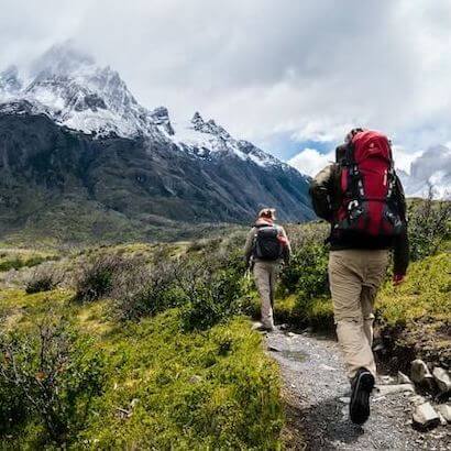
The trek officially begins today as you set out from Khati towards Dwali. After an early breakfast, you’ll start your hike through dense forests, rich with flora and fauna. The trail is moderately challenging, offering a mix of ascents and descents, with the sound of the gushing Pindar River accompanying you along the way. Midway through the trek, you’ll encounter a stunning waterfall, a perfect spot to rest and rejuvenate. As you approach Dwali, the landscape opens up, revealing the majestic peaks that surround this small settlement. You’ll spend the night in Dwali, preparing for the tougher climbs ahead.
Day 3: Dwali to Base Camp
- Highest Altitude: 3,610 meters
- Duration: 12 km, 7-8 hours (Trek)
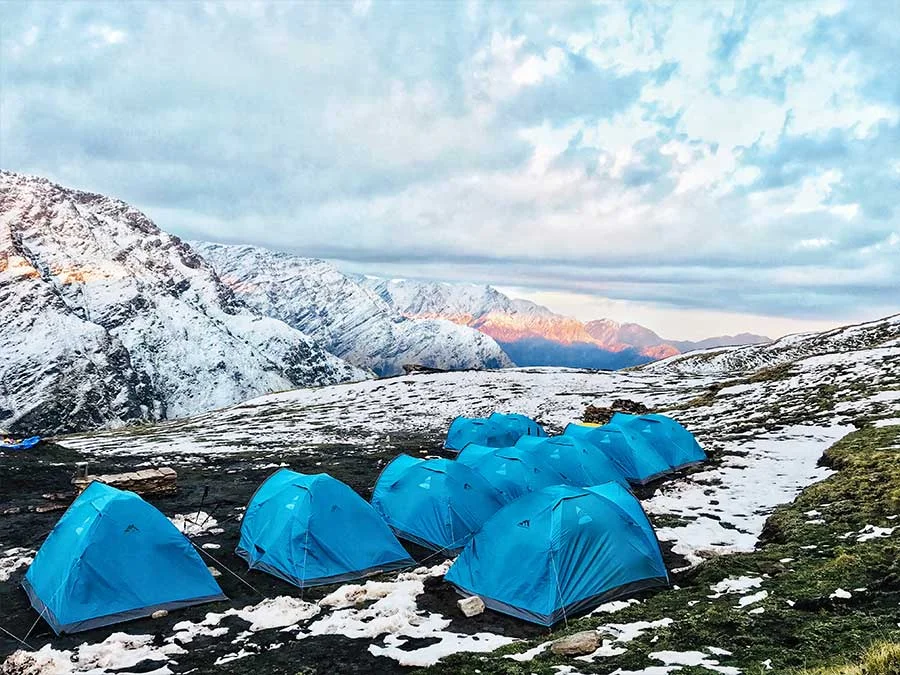
Today’s trek takes you from Dwali to the Base Camp, the staging ground for the higher altitudes. After breakfast, you’ll begin your ascent through alpine meadows, locally known as Bugyals. The trail follows the Pindar River, which you’ll cross via a wooden bridge. As you gain altitude, the vegetation changes, and you’ll be greeted with panoramic views of snow-capped peaks. The trek is moderate but requires a steady pace as you acclimate to the higher altitude. Upon reaching Base Camp, you’ll set up your tents and spend the night under the stars, with the towering peaks providing a dramatic backdrop.
Day 4: Base Camp to Advanced Base Camp (ABC) Load Ferry
- Highest Altitude: 4,435 meters
- Duration: 7 km, 8 hours (Trek)
Acclimatization is key to a successful trek, and today is dedicated to this process. After breakfast, you’ll participate in a load ferry to Advanced Base Camp (ABC). The trail to ABC is steep and challenging, with a significant increase in altitude. The path involves crossing Budhiya Nala, a glacial stream that requires careful navigation. The goal is to carry essential gear and supplies to ABC, preparing it for the following days. After depositing the load, you’ll return to Base Camp for the night, helping your body adjust to the altitude while keeping you physically active.
Day 5: Base Camp to Advanced Base Camp
- Highest Altitude: 4,435 meters
- Duration: 7 km, 7-8 hours (Trek)
Today, you’ll leave Base Camp behind and make the full ascent to Advanced Base Camp. The trek involves crossing Budhiya Nala again and navigating a series of rocky outcrops. The climb is steady, with sections requiring careful footwork, especially as you approach ABC. The reward is worth the effort as ABC offers stunning views of the surrounding peaks and glaciers. This camp will be your base for the next few days as you prepare for the final push towards Traill’s Pass. After setting up camp, you’ll have the evening to relax, acclimatize further, and mentally prepare for the challenges ahead.
Day 6: ABC to Camp 1 Load Ferry
- Highest Altitude: 5,334 meters
- Duration: 6 km, 7-8 hours (Trek)
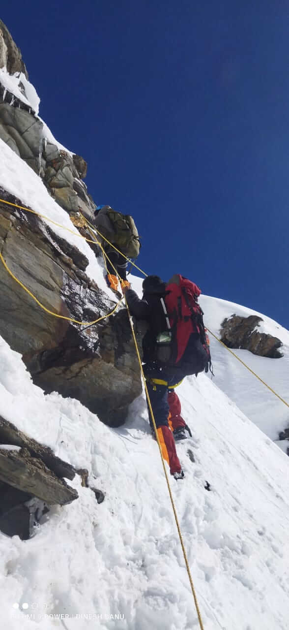
Today, the team splits duties, with some members heading to Camp 1 for a load ferry and others staying back at ABC to rest and acclimatize. The route to Camp 1 involves a steep ascent, including a challenging 200-meter rock wall that requires fixed ropes for safety. This section of the trek is both physically and mentally demanding, but it offers incredible views of the surrounding glaciers and peaks. After reaching Camp 1 and depositing the load, the team returns to ABC. This day is crucial for preparing Camp 1 for the upcoming ascent while allowing everyone to adjust to the thinner air at higher altitudes.
Day 7: ABC to Camp 1
- Highest Altitude: 5,334 meters
- Duration: 6 km, 7-8 hours (Trek)
After breakfast, you’ll break camp at ABC and make the trek to Camp 1. The trail is familiar but remains challenging, especially as you approach the rock wall. This section of the trek offers some of the most dramatic scenery, with towering peaks and vast glaciers all around. The climb requires careful navigation and the use of fixed ropes in certain sections. Upon reaching Camp 1, you’ll set up your tents on the glacier and prepare for the final stages of the trek. The night will be spent at this high altitude, so it’s important to stay hydrated and rest as much as possible.
Day 8: Camp 1 to Camp 2
- Highest Altitude: 5,300 meters
- Duration: 5 km, 7 hours (Trek)
The trek from Camp 1 to Camp 2 is relatively short but requires an early start due to the presence of crevasses and snowfields. As you ascend, the landscape becomes increasingly rugged, with the trail passing through snow-covered terrain. The route involves navigating several snow bridges and carefully avoiding crevasses, making this section of the trek particularly challenging. The day’s trek culminates at Camp 2, located on a relatively flat section of the glacier. Here, you’ll set up camp and prepare for the crossing of Traill’s Pass, the most demanding part of the trek.
Day 9: Camp 2 to Traill’s Pass to Moren Camp
- Highest Altitude: 5,312 meters (Traill’s Pass)
- Lowest Altitude: 4,500 meters (Moren Camp)
- Duration: 7 km, 9-10 hours (Trek)
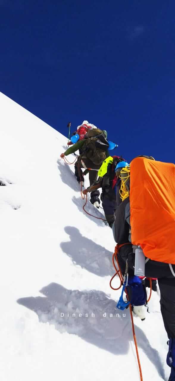
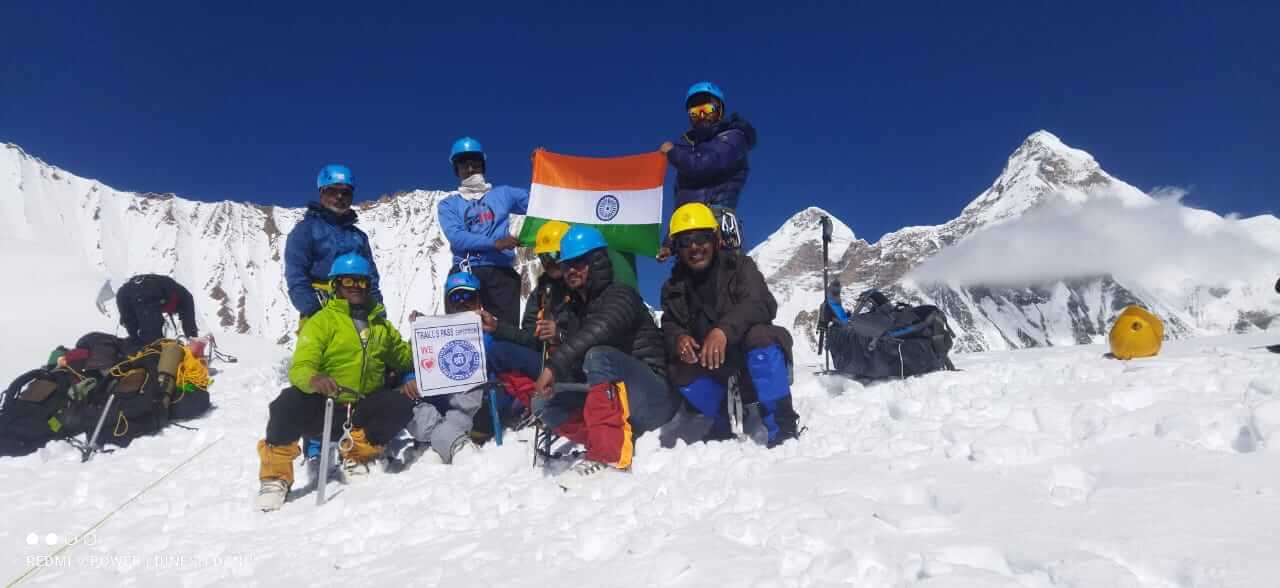
Today is the highlight of the trek as you cross Traill’s Pass. The day begins early, with the team fixing a 600-meter rope to descend onto the glacier below. The descent is steep and technical, requiring concentration and teamwork. Once on the glacier, you’ll traverse the icy expanse before entering a boulder zone, which adds another layer of complexity to the trek. After navigating through the boulders, you’ll reach Moren Camp, located at a lower altitude. The day is long and exhausting but immensely rewarding, with the crossing of Traill’s Pass being a testament to your endurance and skill.
Day 10: Moren Camp to Rata Dantal
- Highest Altitude: 3,700 meters
- Duration: 9 km, 5-6 hours (Trek)
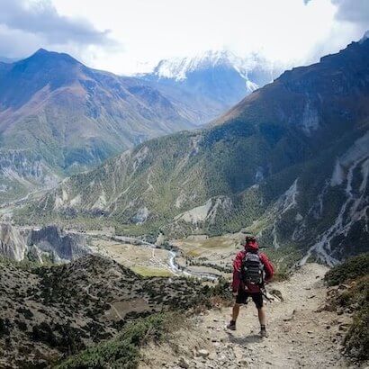
The descent begins in earnest today as you leave the high altitudes behind and head towards Rata Dantal. The trail takes you through the Nanda Devi East Base Camp and Nasanpatti, following the course of the Lawan Gad River. The descent is relatively gentle, allowing you to take in the stunning scenery at a more leisurely pace. Rata Dantal is a beautiful campsite surrounded by alpine meadows and offering clear views of the surrounding peaks. This is a day to enjoy the beauty of the region and reflect on the incredible journey so far.
Day 11: Rata Dantal to Martoli
- Highest Altitude: 3,367 meters
- Duration: 10 km, 6-7 hours (Trek)
After breakfast, you’ll continue your descent towards Martoli, a picturesque village with some of the best views of Nanda Devi and other prominent peaks. The trail passes through Lawan village, offering a glimpse into the traditional lifestyle of the local Bhotia community. Martoli is a historic settlement with old stone houses and a rich cultural heritage. It’s a perfect place to spend the night, surrounded by the beauty of the meadows and the towering peaks. The evening can be spent exploring the village and interacting with the locals, adding a cultural dimension to your trekking experience.
Day 12: Martoli to Munsiyari
- Highest Altitude: 2,450 meters
- Trek Duration: 3 km (martoli to railkot)
- Drive: 45kms (via bugdyar nilam)
Today’s trek is long but scenic, as you make your way from Martoli to Munsiyari. The trail gradually descends, following the course
Things to Carry
| Backpack with rain cover | (50 – 60 ltr) with comfortable shoulder straps |
| Day pack with rain cover | 20 – 30 ltr (If off-load opted) |
| Walking stick | Advisable (At least one) |
| Water Bottle / Hydration pack | 2 bottles of one liter each, People who use hydration pack 1 hydration pack and 1 bottle of one liter, Carry at least one thermos flask. |
| Small size tiffin/lunch box | 1 Nos |
| Snacks | Energy bars, dry fruits, electoral/ors |
| Personal Medical Kit | Consult your doctor |
| T-Shirt (Synthetic quick dry) | 1 Full & 2 Half sleeves |
| Fleece T-shirt | 1 Nos |
| Wind stopper / Fleece jacket | 1 Nos |
| Windproof Jacket | 1 Nos |
| Down feather / Hollow jacket | 1 Nos |
| Thermal inner (Upper and Lower) | 1 Pair |
| Trek Pant (Synthetic quick dry) | 2 Nos |
| Wind stopper / Fleece Pant | 1 Nos |
| Waterproof gloves | 1 Pair |
| Fleece / woollen gloves | 1 Pair |
| Poncho / waterproof Jacket and pant | 1 Nos |
| Head torch | 1 Nos. (Avoid Hand torch) |
| Sun Cap | 1 Nos |
| Woolen cap | 1 Nos. |
| Balaclava | 1 Nos. |
| Buff | 1 Synthetic & 1 Woollen |
| Sunglasses | UV with dark side cover, People who wear spectacles – (A)- Use contact lenses | (B)- Photo chromatic glasses |
| Trekking shoes | 1 Pair (Waterproof, high ankle, good grip) |
| Floaters / flip-flops | 1 Pair |
| Cotton socks | 6 pairs |
| Woollen socks | 1 pairs |
| Gaiters | 1 Pair (We will provide when required) |
| Micro spikes | 1 Pair (We will provide when required) |
Inclusion & Exclusion
- Meals during the trek
- Forest Permits/Camping Charges. Included only upto amount charged for Indian Nationals
- Tents, Sleeping bags, mats
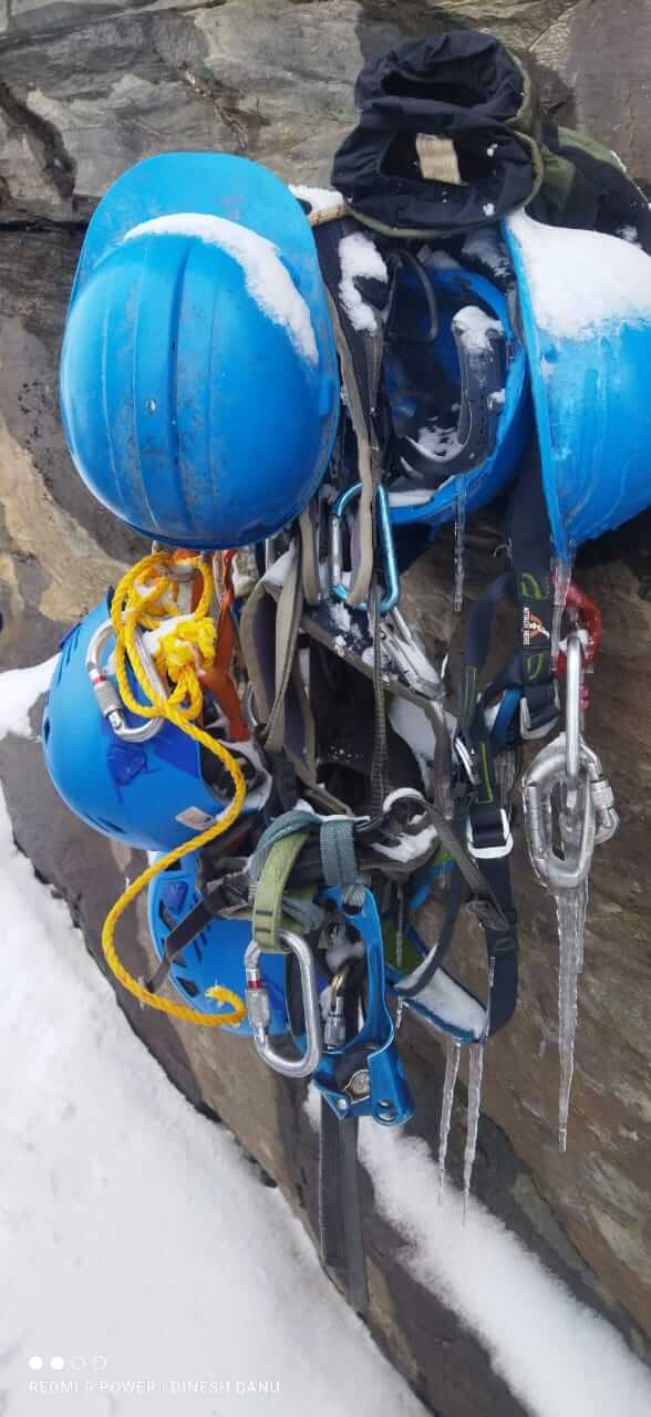
- Safety Equipment includes static rescue rope, seat harness, carabiners, pulleys
- Trek guide, cook, helpers, porters & mules for carrying common luggage
- Services of a Certified Trek Leader
- Imap permission
- Meals during road journeys
- Carriage of Personal Bags during the trek
- Any kind of Insurance
- Any expense of personal nature
- Any expense not specified in the inclusion list.
- 800/Bag/Day - Offloading (Weight - 10-12 Kg)
FAQ's
Thrail Pass is located in the Kumau region of Uttarakhand, offering a unique trekking experience through untouched landscapes. The pass is known for its remote beauty, high-altitude meadows, and dramatic mountain views, making it a hidden gem for trekkers looking to explore offbeat Himalayan routes.
The best time for the Thrail Pass Trek is from May to June and September to October. These months provide clear skies, pleasant weather, and stable trail conditions, making the trek safer and more enjoyable while offering spectacular views of the surrounding peaks.
The Thrail Pass Trek is classified as moderately challenging, with steep ascents, high-altitude trekking, and unpredictable weather conditions. It requires a good level of physical fitness and stamina, especially for handling long days of trekking and camping at altitudes above 4,000 meters.
Trekkers need to acquire a trekking permit from the local forest authorities in Uttarakhand, as the trail passes through protected forest areas and alpine meadows. It is essential to follow local regulations to preserve the environment and ensure the safety of trekkers.
For the Thrail Pass Trek, pack layers of warm clothing, sturdy trekking boots, a sleeping bag, and a waterproof tent. Other essentials include trekking poles, a headlamp, first aid kit, and sufficient high-energy snacks. It's also crucial to carry rain gear, as the weather in high-altitude areas can change rapidly.
Gallery
Expedition Route

