
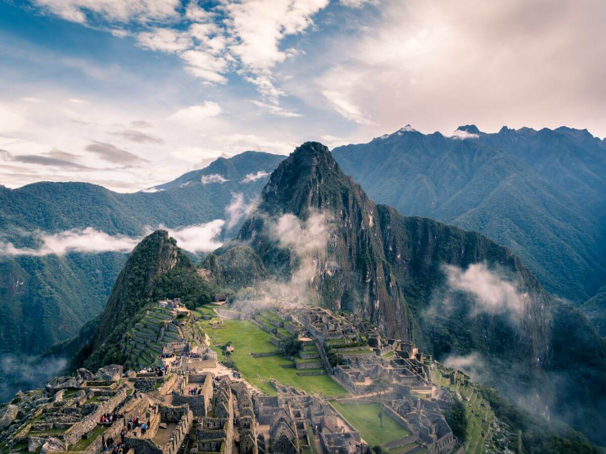
↜ Experience the beautiful Kumaon Himalayas ↝
Kanakata Pass Trek
Region
Kathgodam
Duration
9 Days
Max Altitude
15348 Ft.
Trekking
64 KM
Grade
Difficult
Overview
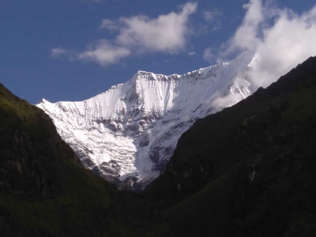
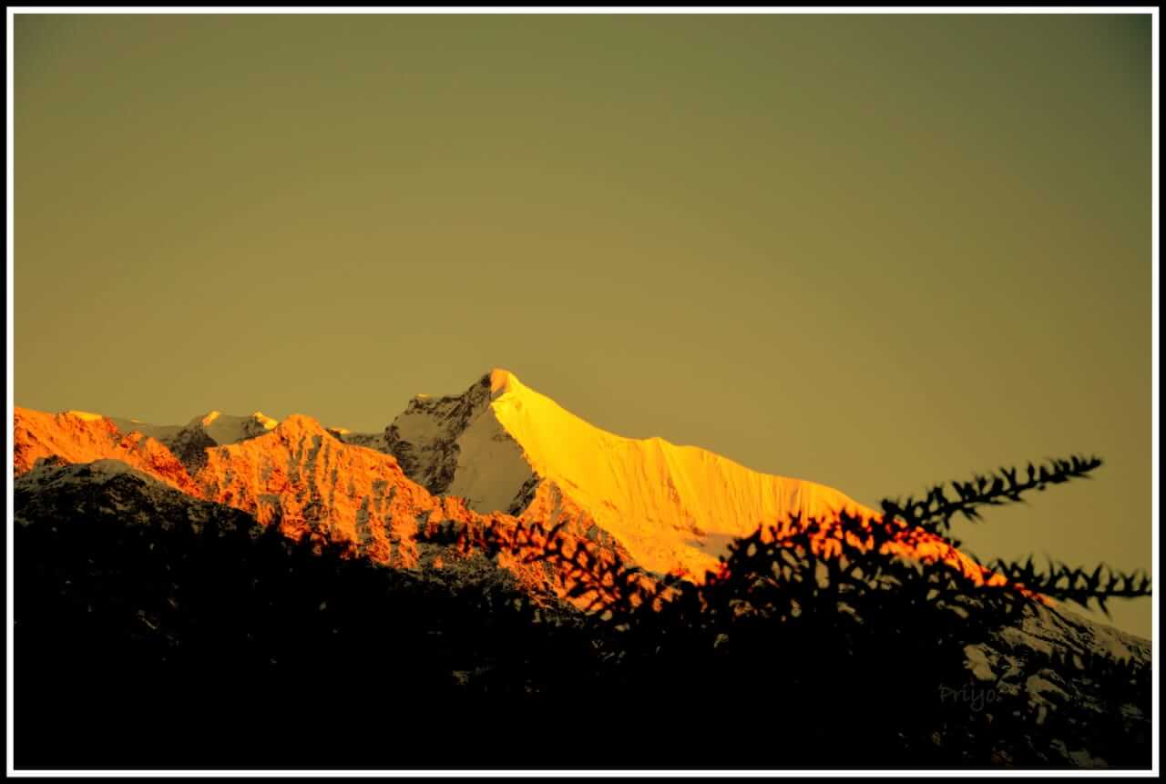
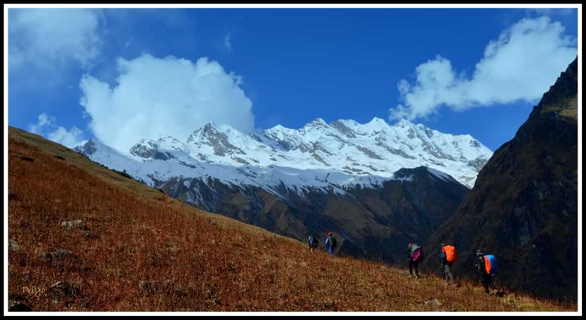
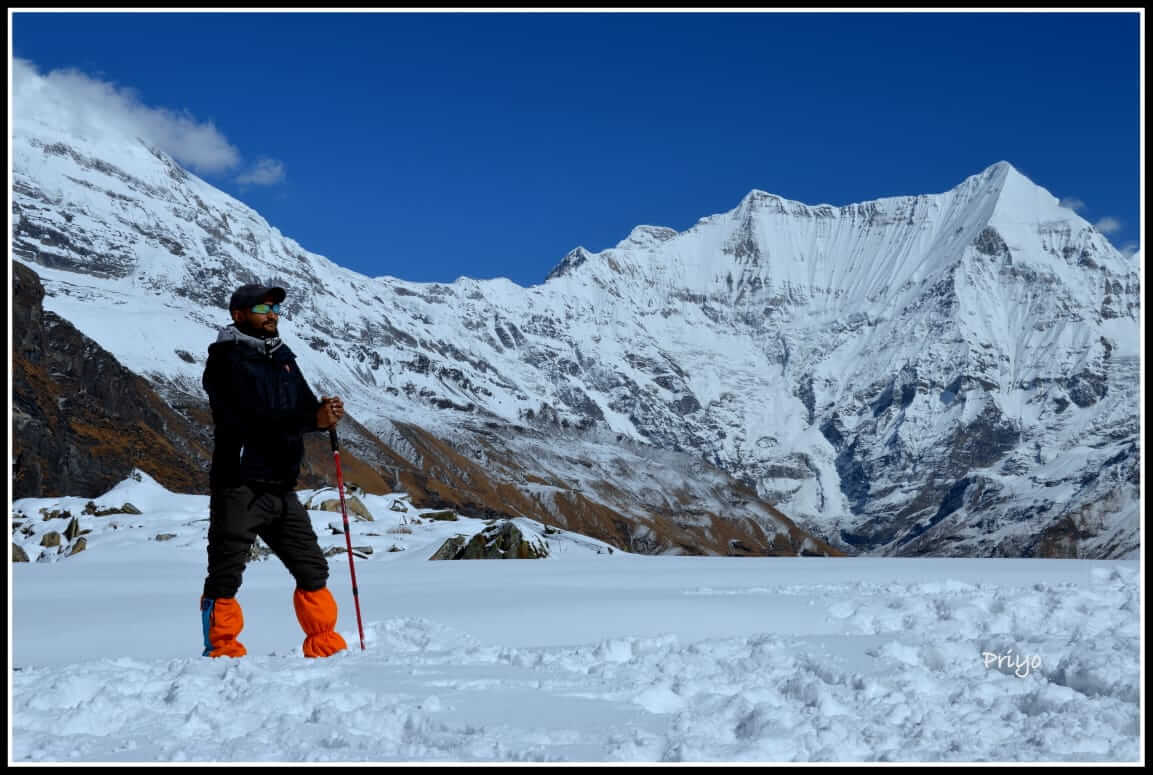
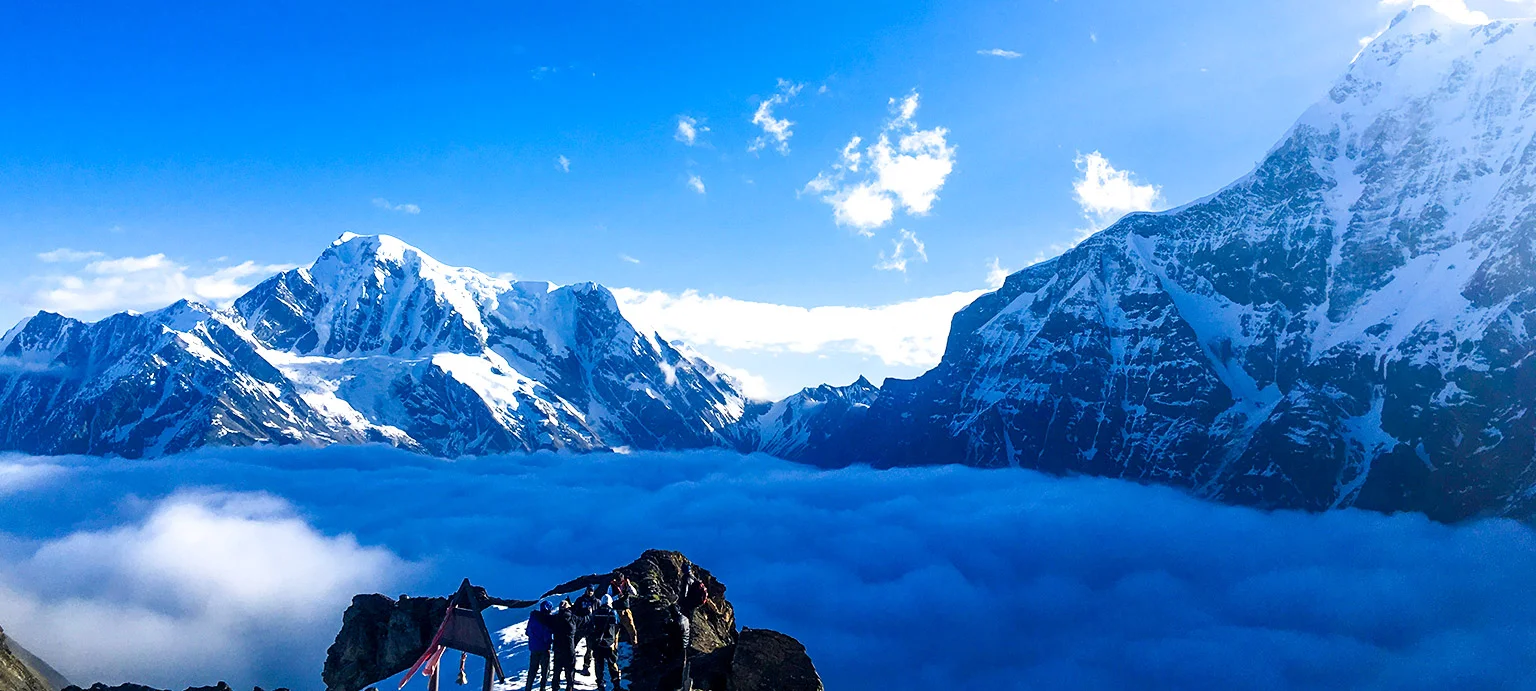
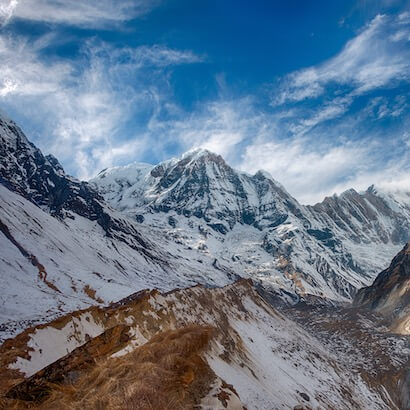
The Kanakata Pass Trek is a hidden gem nestled in the Kumaon region of Uttarakhand, offering adventure enthusiasts an opportunity to experience pristine landscapes and untouched wilderness. This high-altitude trek, reaching elevations of over 4,200 meters, promises stunning views of the towering peaks of Nanda Devi, Nanda Kot, and Panwali Dwar. The trail takes trekkers through dense forests, scenic meadows, alpine lakes, and ancient villages, providing a perfect balance of natural beauty and cultural immersion.
Starting from the charming village of Khati, the trek gradually ascends through remote terrains, passing through destinations like Jatoli and Kathelia, before reaching the challenging yet rewarding Kanakata Pass. The trek is known for its breathtaking vistas, including mesmerizing sunrises and sunsets over snow-capped peaks, as well as the tranquility of the secluded environment.
- Base Camp: Khati
- Season: Summer | Autumn
- Month: May | June | September | October
- Rail Head: Kathgodam
- Airport : Pant Nagar
- Stay: Camping (Twin sharing) & Hotel/Guesthouse (Separate for male & Female)
- Network : khati ( BSNL )
- Food: Meals while on trek & at Hotel/Guesthouse (Veg & Eggs)
- ATM : Kapkot
Itinerary
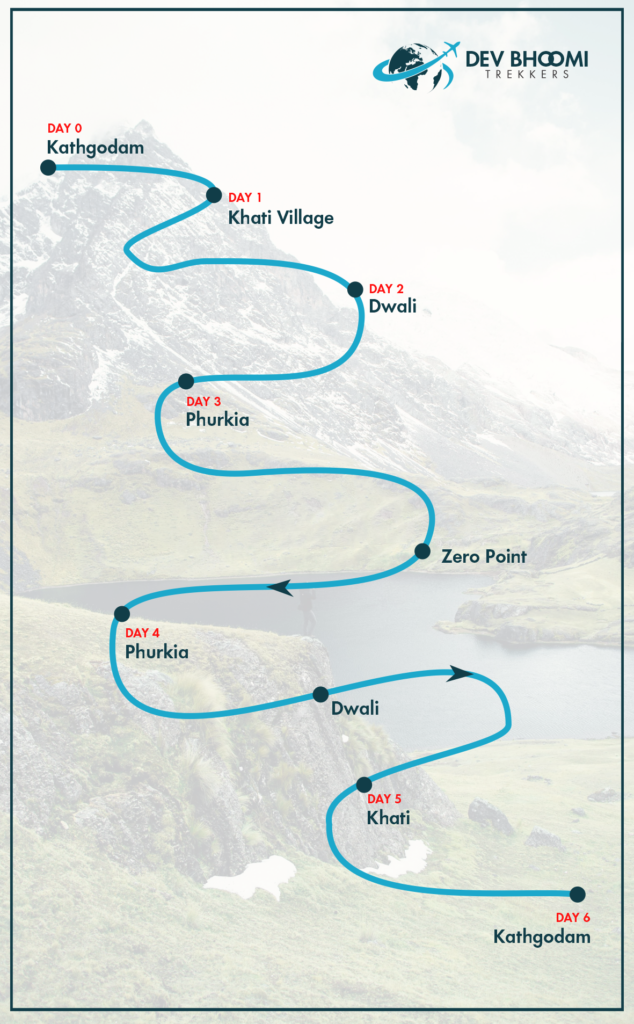
Day 1: Kathgodam to Khati
- Duration: 225 km, 9/10 hours drive
- Altitude: 2,210 meters
Day 2: Khati to Jatoli
- Duration: 7 km trek, 5/6 hours
- Highest Altitude: 2,440 meters
Day 3: Jatoli to Kathelia
- Duration: 12 km trek, 8/9 hours
- Highest Altitude: 2,915 meters
Day 4: Kathelia to Devikund
- Duration: 9 km trek, 7/8 hours
- Highest Altitude: 4,350 meters
Day 5: Devikund to Nagkund
- Duration: 5 km trek, 3/4 hours
- Highest Altitude: 4,450 meters
Day 6: Nagkund to Patherkunia via Kanakata Pass
- Duration: 6 km trek, 6/7 hours
- Highest Altitude: 4,680 meters
Day 7: Kanakata Pass to Jatuli (downwards)
- Duration: 9 km trek, 6/7 hours
- Highest Altitude: 2450 meters
Day 8: Jatuli to Bageshwar
- Duration: 7 km trek, 3/4 hours
- Drive: 62kms, 3hrs
Day 9: Bageshwar to Kathgodam
- Duration: 160 km trek, 6/7 hours
Day 1: Kathgodam to Khati
- Duration: 225 km, 9/10 hours drive
- Altitude: 2,210 meters
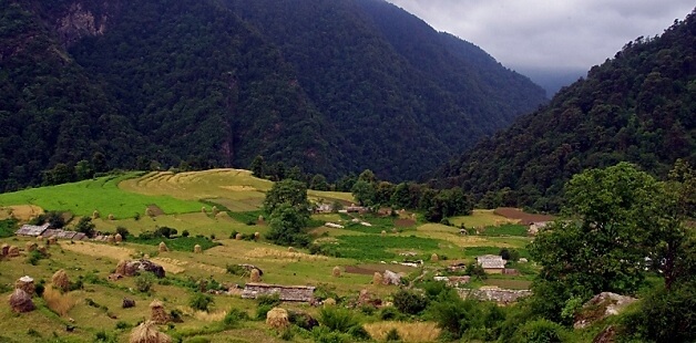
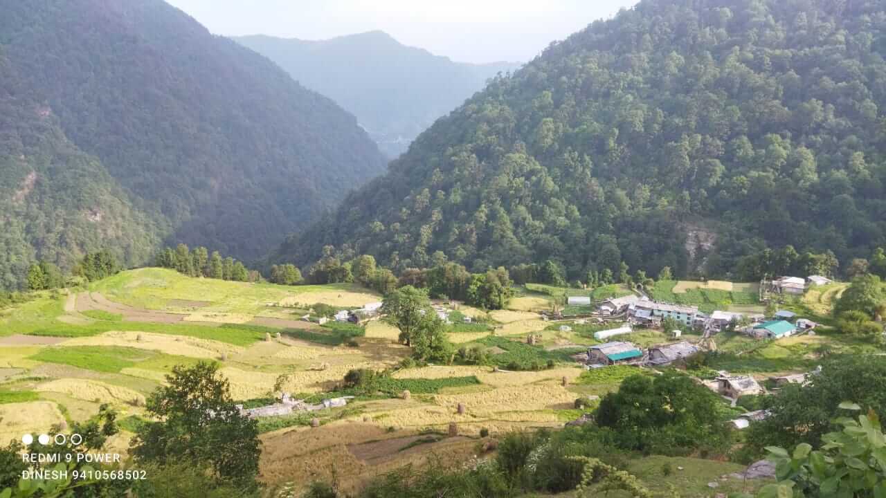
Your journey begins from Kathgodam, the gateway to the Kumaon region of Uttarakhand. From here, you embark on a scenic drive through the winding roads of Almora, Bageshwar, and Kapkot, eventually reaching the picturesque village of Khati. Nestled at an altitude of 2,210 meters, Khati is the last inhabited village on this trekking route and serves as a base for both the Pindari and Kafni Glacier treks. This charming village is home to a beautiful temple dedicated to Kali Maa and Nanda Maa, making it a spiritual haven. The village offers accommodations in home stays, hotels, and PWD rest houses. Khati is not just a place to rest, but also an opportunity to immerse yourself in the local culture and enjoy the panoramic views of the surrounding mountains.
Day 2: Khati to Jatoli
- Duration: 7 km trek, 5/6 hours
- Highest Altitude: 2,440 meters
After a hearty breakfast, the trek from Khati to Jatoli begins. The route takes you through dense forests where you’ll encounter a variety of flora, including Kharsu, Walnut, Utish Maple, and Rhododendron trees. The path is a mix of gentle ascents and descents, with the soothing sound of the Pinder River accompanying you for a significant part of the journey. After crossing the confluence of the Pinder and Sundar Dhunga rivers, the trail leads you to the quaint settlement of Jatoli. This village is not separate but a ward of the larger Wachham village. The centerpiece of Jatoli is the grand temple of Bhumiyal Devta, which is revered by locals. Accommodations here include local homestays and a KMVN rest house, providing a cozy retreat after a day’s trek.
Day 3: Jatoli to Kathelia
- Duration: 12 km trek, 8/9 hours
- Highest Altitude: 2,915 meters
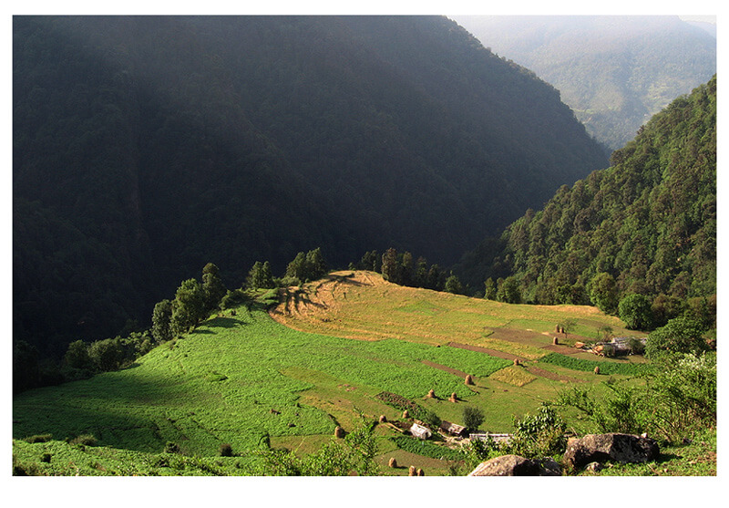
The trek from Jatoli to Kathelia is an adventurous journey through dense forests, cascading waterfalls, and the serene Sundar Dhunga Valley. The trail is challenging, with numerous ascents and descents, but the stunning natural beauty makes it worthwhile. As you follow the Sundar Dhunga River, you might spot various species of birds and wildlife, making this trek a delight for nature lovers. Upon reaching Kathelia, you’ll find yourself at the gateway to the Sundar Dhunga Glacier. This remote area lacks permanent settlements, so you’ll set up camp in the valley. The convergence of the Maktoli and Sukram rivers adds to the charm of this secluded location. From here, the trail bifurcates, leading to Maktoli Base Camp on one side and the Sundar Dhunga Glacier on the other.
Day 4: Kathelia to Devikund
- Duration: 9 km trek, 7/8 hours
- Highest Altitude: 4,350 meters
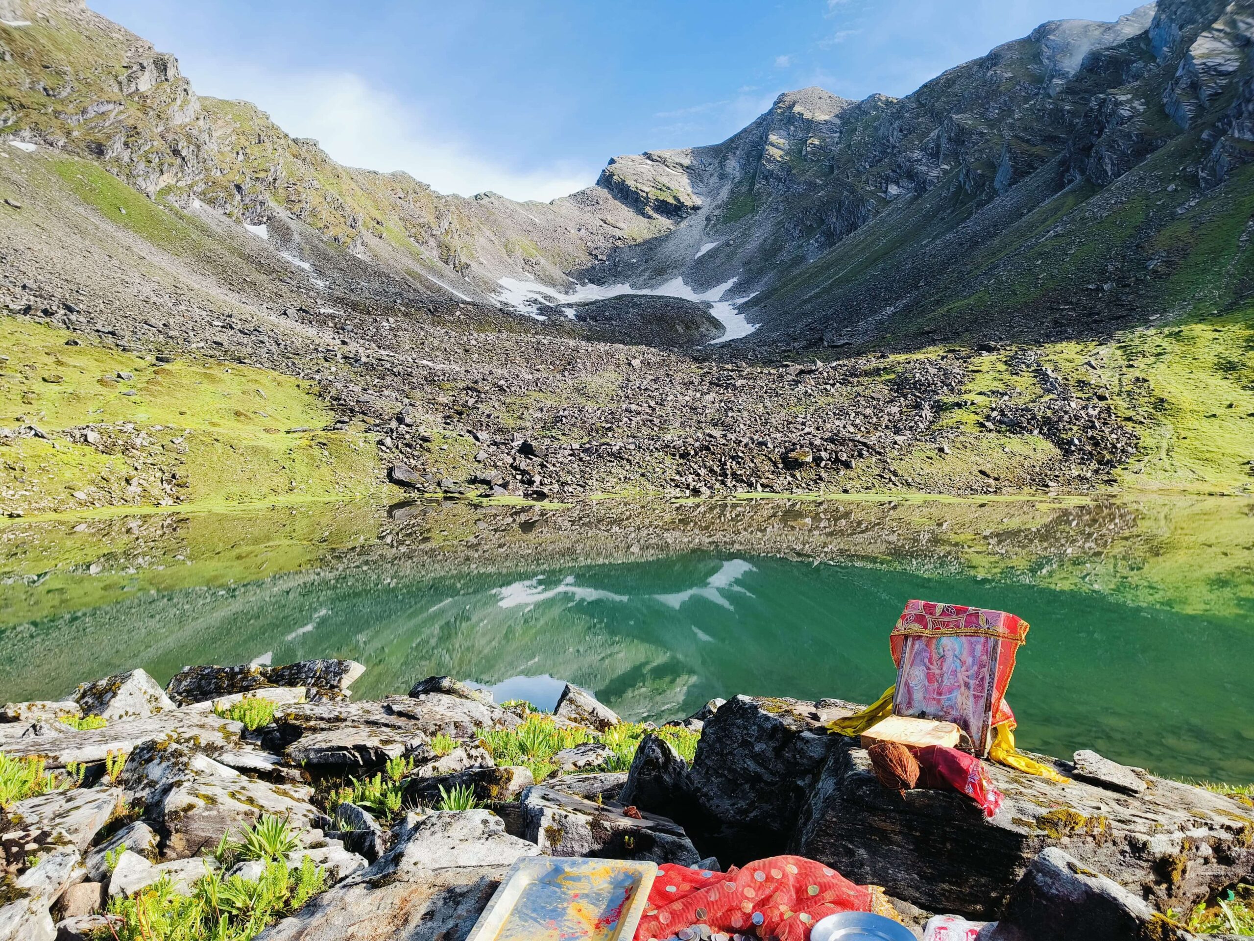
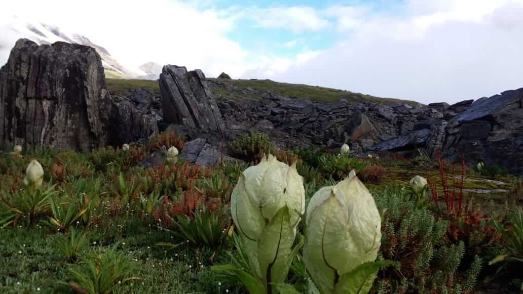
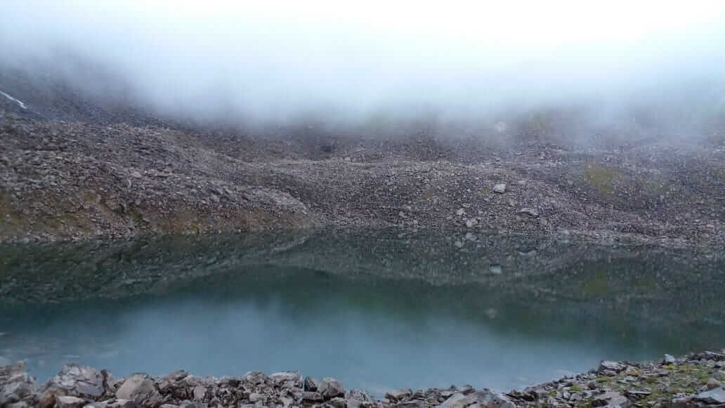
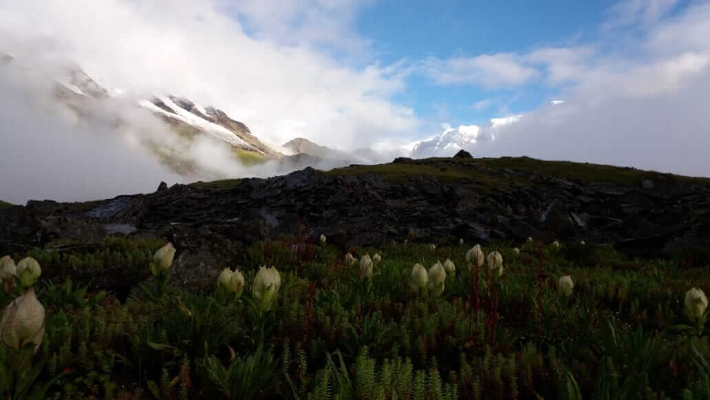
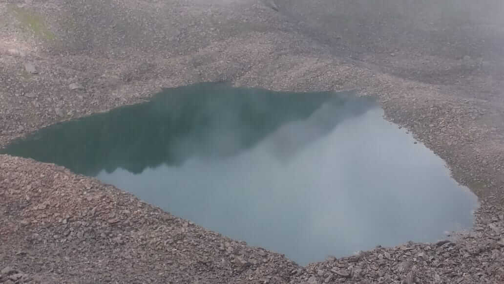
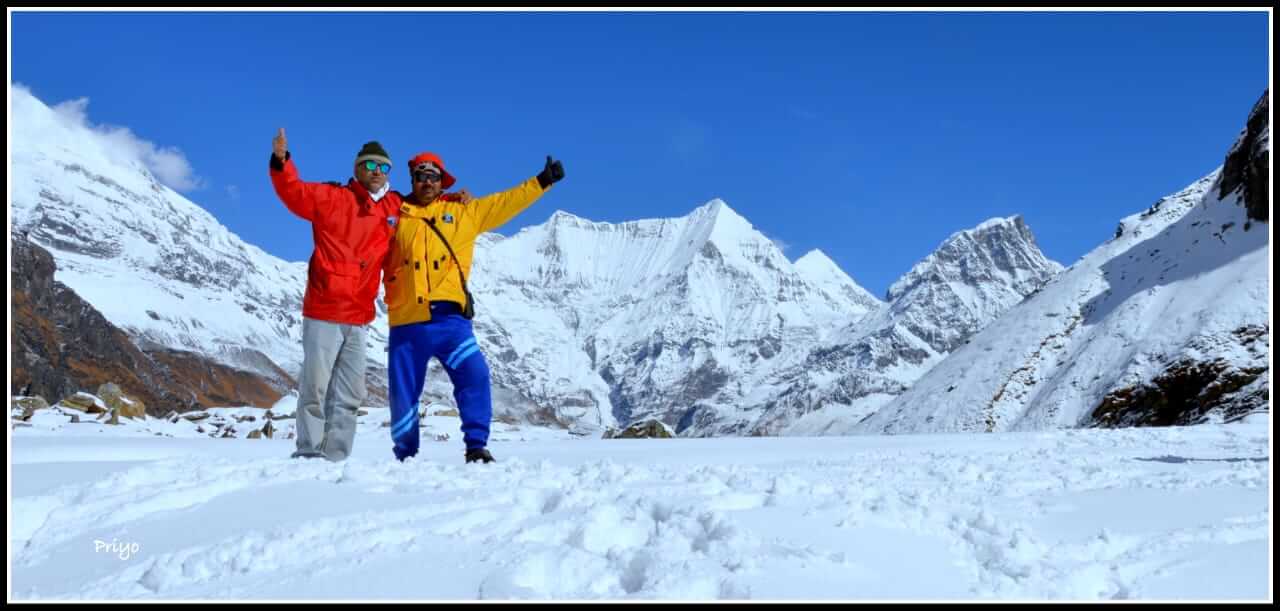
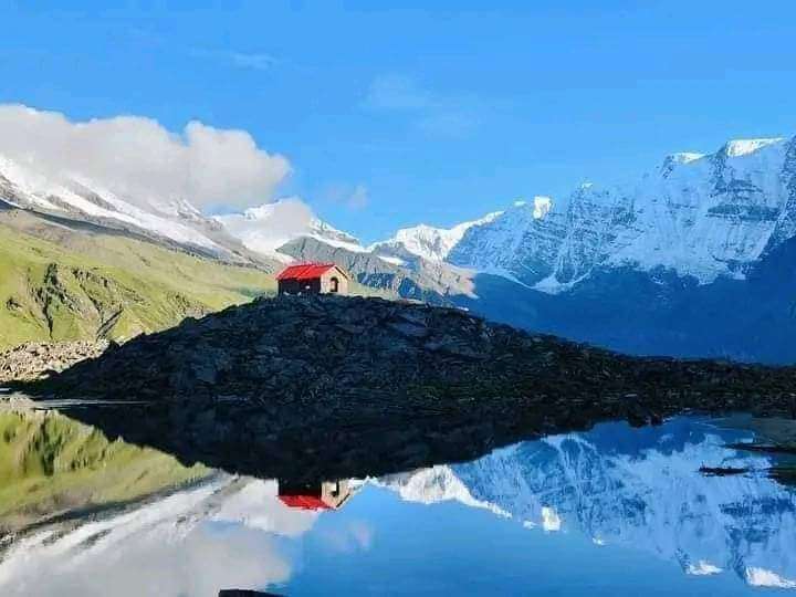
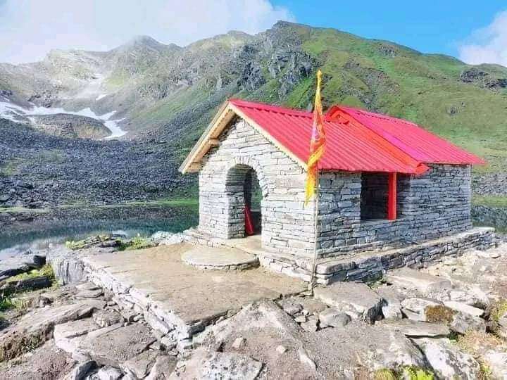
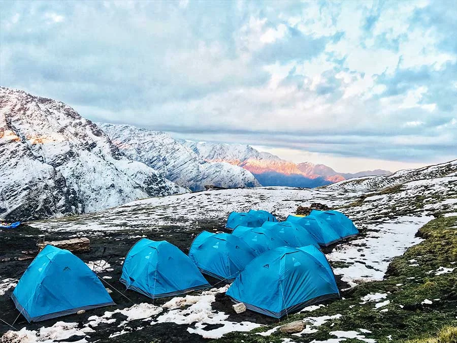
The trek from Kathelia to Devikund is a mesmerizing journey that takes you deeper into the Sundar Dhunga Valley. The day starts with a steady climb, offering breathtaking views of towering peaks like Mount Bhanoti, Mount Durgakot, Tent Peak, Mount Tharkot, Trisul, and Mirgithuni. The trail leads you to Baluni Bugyal, a high-altitude meadow that serves as the summit of the Sundar Dhunga Glacier. As you ascend towards Devikund, the landscape transforms into a pristine alpine environment. Devikund is not just a trekker’s paradise but also a place of religious significance. The serene lake here is believed to have been created by Maa Bhagwati for her bath, and the reflection of the surrounding peaks in its waters is a sight to behold. You’ll camp here for the night, under the starry Himalayan sky.
Day 5: Devikund to Nagkund
- Duration: 5 km trek, 3/4 hours
- Highest Altitude: 4,450 meters
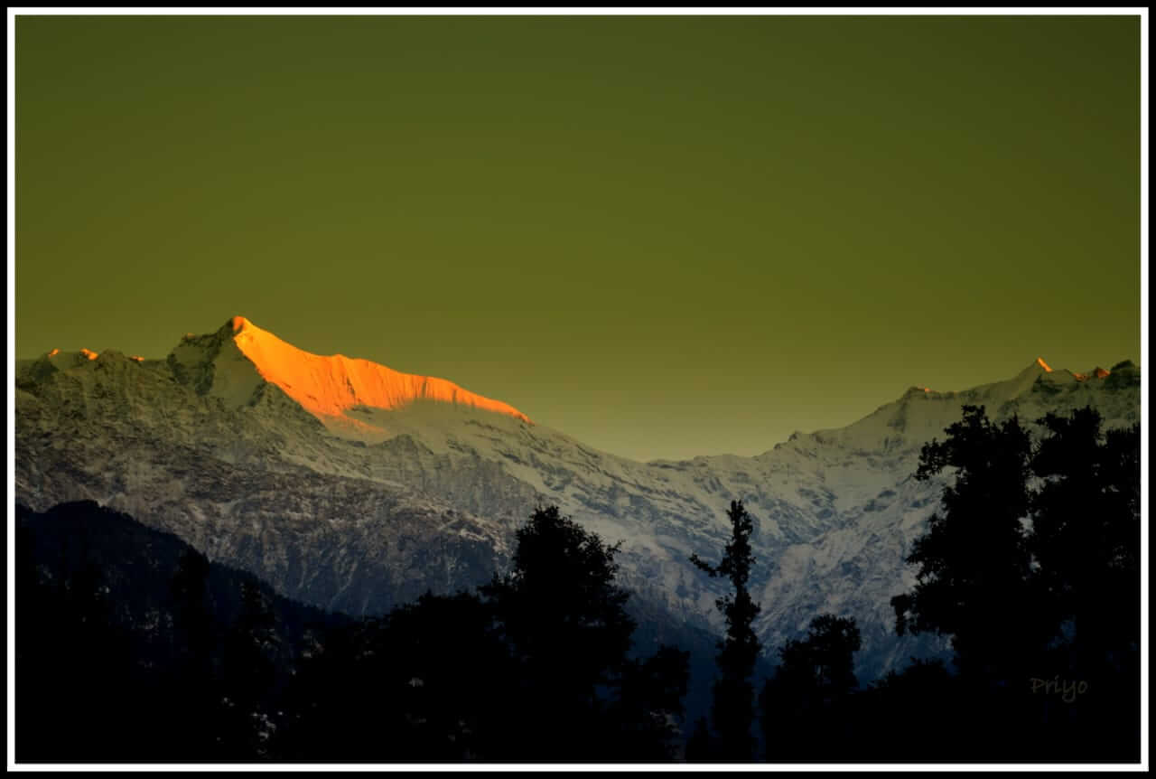
The morning at Devikund offers a breathtaking sunrise, with the golden rays of the sun lighting up the surrounding peaks. After breakfast, the trek continues towards Nagkund, another sacred site associated with Maa Bhagwati. The trail from Devikund to Nagkund is a mix of rocky terrain and alpine meadows, with the reflection of the peaks in the serene waters of the kund creating a surreal experience. Nagkund is a smaller lake compared to Devikund, but it holds its own mystical charm. The campsite near the kund is small, but it provides a peaceful retreat for the night.
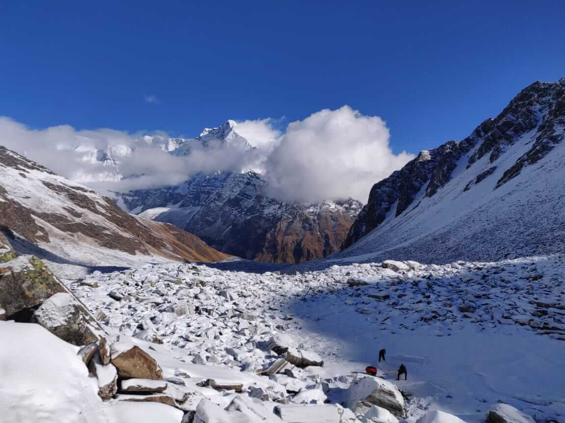
Day 6: Nagkund to Patherkunia via Kanakata Pass
- Duration: 6 km trek, 6/7 hours
- Highest Altitude: 4,680 meters
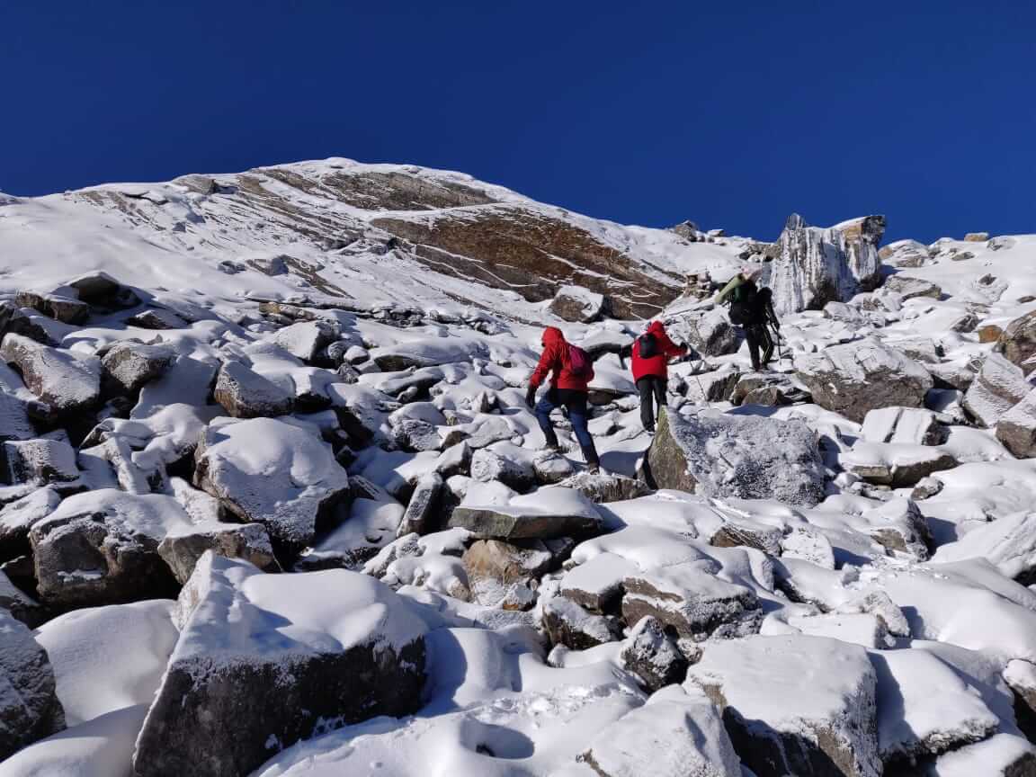
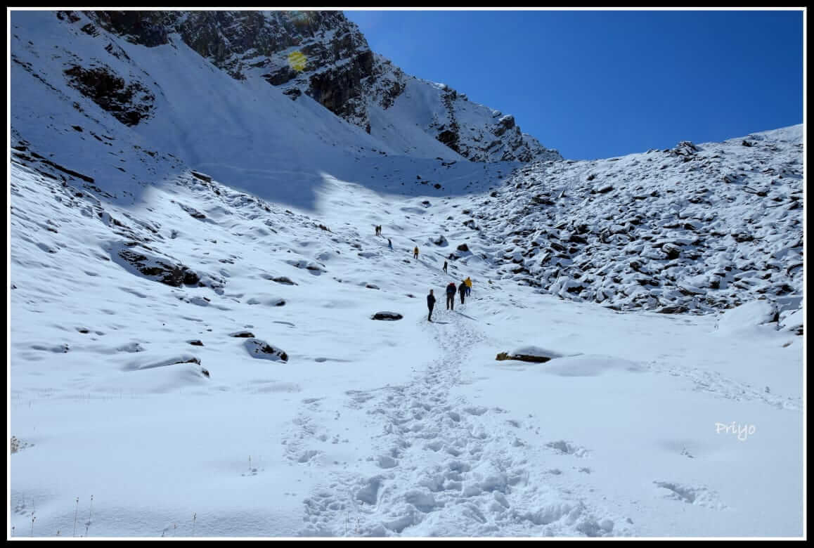
The trek from Nagkund to Patherkunia via Kanakata Pass is the most challenging day of the journey. The trail involves a steep climb up to the Kanakata Pass, which offers panoramic views of the surrounding peaks and valleys. The pass is named “Kanakata” due to the ear-shaped rock formations found here. After crossing the pass, the trail descends towards Patherkunia, a rocky campsite surrounded by towering peaks. This area is known for its rugged beauty and is a favorite among trekkers seeking solitude in the mountains.
Day 7: Kanakata Pass to Jatuli (downwards)
- Duration: 9 km trek, 6/7 hours
- Highest Altitude: 2450 meters
Day 8: Jatuli to Bageshwar
- Duration: 7 km trek, 3/4 hours
- Drive: 62kms, 3hrs
Day 9: Bageshwar to Kathgodam
- Duration: 160 km trek, 6/7 hours
Things to Carry
| Backpack with rain cover | (50 – 60 ltr) with comfortable shoulder straps |
| Day pack with rain cover | 20 – 30 ltr (If off-load opted) |
| Walking stick | Advisable (At least one) |
| Water Bottle / Hydration pack | 2 bottles of one liter each, People who use hydration pack 1 hydration pack and 1 bottle of one liter, Carry at least one thermos flask. |
| Small size tiffin/lunch box | 1 Nos |
| Snacks | Energy bars, dry fruits, electoral/ors |
| Personal Medical Kit | Consult your doctor |
| T-Shirt (Synthetic quick dry) | 1 Full & 2 Half sleeves |
| Fleece T-shirt | 1 Nos |
| Wind stopper / Fleece jacket | 1 Nos |
| Windproof Jacket | 1 Nos |
| Down feather / Hollow jacket | 1 Nos |
| Thermal inner (Upper and Lower) | 1 Pair |
| Trek Pant (Synthetic quick dry) | 2 Nos |
| Wind stopper / Fleece Pant | 1 Nos |
| Waterproof gloves | 1 Pair |
| Fleece / woollen gloves | 1 Pair |
| Poncho / waterproof Jacket and pant | 1 Nos |
| Head torch | 1 Nos. (Avoid Hand torch) |
| Sun Cap | 1 Nos |
| Woolen cap | 1 Nos. |
| Balaclava | 1 Nos. |
| Buff | 1 Synthetic & 1 Woollen |
| Sunglasses | UV with dark side cover, People who wear spectacles – (A)- Use contact lenses | (B)- Photo chromatic glasses |
| Trekking shoes | 1 Pair (Waterproof, high ankle, good grip) |
| Floaters / flip-flops | 1 Pair |
| Cotton socks | 6 pairs |
| Woollen socks | 1 pairs |
| Gaiters | 1 Pair (We will provide when required) |
| Micro spikes | 1 Pair (We will provide when required) |
Inclusion & Exclusion
- Meals during the trek
- Forest Permits/Camping Charges. Included only upto amount charged for Indian Nationals
- Tents, Sleeping bags, mats
- Safety Equipment includes static rescue rope, seat harness, carabiners, pulleys
- Trek guide, cook, helpers, porters & mules for carrying common luggage
- Services of a Certified Trek Leader
- Meals during road journeys
- Carriage of Personal Bags during the trek
- Any kind of Insurance
- Any expense of personal nature
- Any expense not specified in the inclusion list.
- 400/Bag/Day - Offloading (Weight - 10-12 Kg)
FAQ's
The best time to trek Kanakata Pass is from May to mid-June and September to October. During these periods, the weather is generally clear, and the trail offers breathtaking views of the surrounding peaks and valleys. The spring season showcases blooming flowers, while autumn brings crisp air and clear skies for stargazing.
The Kanakata Pass Trek is considered moderately challenging, so a good level of fitness is essential. Trekkers should be comfortable walking 6-8 hours daily with varying elevations. It is recommended to have some prior trekking experience and endurance training before embarking on this trek.
The Kanakata Pass Trek typically takes around 7 to 9 days to complete, depending on the route and itinerary chosen. This includes the time needed for acclimatization and rest days, ensuring trekkers can adjust to the higher altitudes safely.
Yes, camping is necessary during the Kanakata Pass Trek as there are limited accommodation options along the route. Trekkers will need to carry their own tents, sleeping bags, and other camping equipment, or they can join a guided trek where these provisions are provided.
Yes, permits are required to undertake the Kanakata Pass Trek as it falls in a restricted area in the Himalayan region. Trekkers must obtain the necessary permits from the local authorities or arrange them through a trekking agency prior to the trek.
Gallery
Trek Route
